
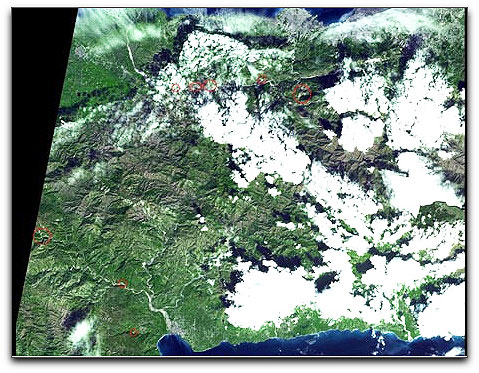
Landslides from the Jan. 12 Haiti earthquake are clearly visible in a new simulated natural-color image from an instrument on NASA's Terra spacecraft. Image credit: NASA/GSFC/METI/ERSDAC/JAROS, and U.S./Japan ASTER Science Team
While ASTER's 15-meter (50-foot) resolution is not sufficient to see damaged buildings, it can be used to identify other results of the shaking. The red circles superimposed on the image indicate possible landslides, a common occurrence in mountainous terrain after large earthquakes. The possible landslides were identified by carefully comparing the new image with an image acquired one year previously.