

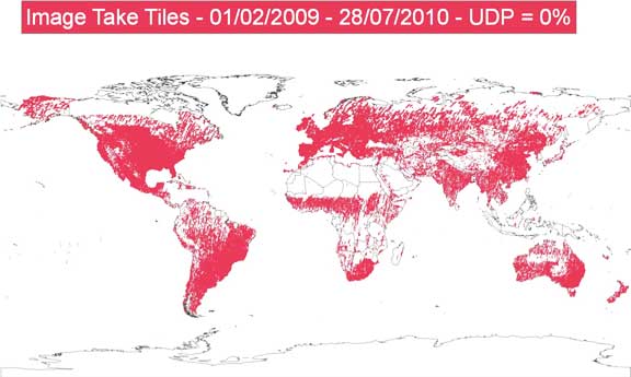
As a major milestone, RapidEye imaged its one billionth square kilometer of the surface of the Earth this year since commercial operations began on February 4, 2009. All of this data collected over the last 14 months is available in its library, which contains multiple datasets including the freshest images. Also, RapidEye successfully completed its background mission in North America and collected more than 95 percent of the U.S. over the last 3 months. The RapidEye Library is continuously growing as new images are downloaded from its satellite constellation each day. Earlier this year, RapidEye successfully completed an imaging campaign over China and collected 7.8 Million km² of the country far ahead of schedule. The contract between RapidEye and the Ministry of Land and Resources (MLR) for the People's Republic of China, was coordinated through RapidEye's Chinese distributor, Beijing Earth Observation. The MLR will be mainly using the imagery to protect their agricultural lands from urban sprawl. Even though the contract with the MLR was only for 80 percent of the country, RapidEye has imaged China in its entirety (9.6 Million km²). The images are available in the RapidEye Library.
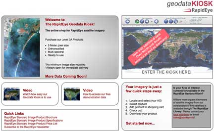
In December 2009, RapidEye opened the RapidEye Geodata Kiosk, an online shop for satellite imagery with ready-to-use data available immediately after purchase. More than 20 Million km² of satellite imagery, including a vast majority of North America and Europe, are available for download. Recent emergency events such as the earthquakes in Haiti and Chile, as well as the oil spill incident in the Gulf of Mexico, have shown that satellite imagery plays a great part in being able to support relief efforts. In early 2010, RapidEye completed imaging the regions in Haiti that have been most affected by the 7.0-magnitude earthquake in January.
RapidEye has also imaged the area next to the epicenter of the heavy 8.8-magnitude earthquake in Chile in February this year, and completed change detection analysis to depict vegetation changes in rural areas and flooding in urban areas. The area around the Gulf of Mexico was covered several times since the oil spill occurred. RapidEye also has fresh images of the coast line before the oil spill, thereby opening the door for an in-depth analysis of the effects of this disaster on the region.
Over the last months, RapidEye has expanded its distribution network to more than 15 distributors to cover new markets in Eastern Europe and Asia and is excited to welcome the new and challenging requests they can bring for RapidEye. RapidEye will be attending this year's INTERGEO with its distributors Santiago & Cintra Consultoria from Brazil, and BEO from China, in Cologne, Germany.