
In this image, the red vegetation is healthy and the black areas are burning, or have been burnt. This image has been rotated so that North is left — the town of Bastrop is just off the lower right, and Paige, Texas is located in the upper left. The road running up and down the upper left is HWY 290. The road running up and down the right is HWY 71. LUECKE is a pattern of trees, spelling out the name of a local farmer.
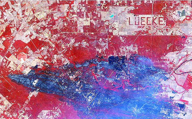
Photo is courtesy of DigitalGlobe