ScanEx + WWF... Walrus Whereabouts (Imagery)
[SatNews] Supported by the World Wildlife Fund (WWF) and the Marine Mammal Council, ScanEx Research & Development Center in 2011 launched a project....
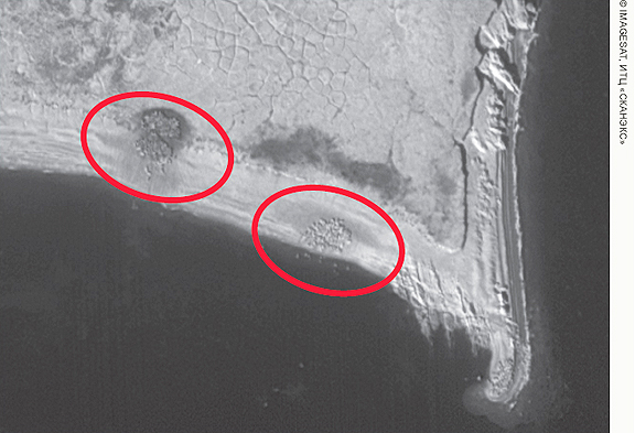 Walrus whelping spots on the Matveev Island, “Nenetsky” state strict nature reserve. EROS B image, acquired on 04.09.2011 (c) Imagesat Int., ScanEx RDC, 2011
....to fine-tune the method of interpretation based on space imagery of locations of walrus on the south-east of the
Barents Sea. The quality of received images enabled researchers to detect these animal species gatherings, as well as their approximate numbers. Inadequate knowledge of the Atlantic walrus is a serious obstacle to work out measures to minimize adverse impact on the animals from oil spills and gas developments. The booklet
Space technology for the marine mammal research and conservation in the Arctic. Results of the pilot project to develop methods of finding walruses on satellite images has been prepared and published on the WWF website.
Satellite imagery was used for the first time to detect the walruses and to assess their number in summer-autumn period. Due to the success of the first pilot project to develop methods of finding the most probable locations of the coastal rookeries via satellite, WWF Russia in 2012 plans to extend rookeries monitoring and analyze images from Barents, Kara, Laptev and East-Siberian Seas.
Topical Tags :
Regional Tags :
