
Following initial testing, the satellite was brought to an altitude of around 158 miles, which is extremely low for an Earth observation satellite, the ESA said. As gravity is stronger closer to Earth, the satellite will orbit as low as possible while remaining stable as it flies through the fringes of Earth's atmosphere. "We are now entering science operations and are looking forward to receiving and processing excellent three-dimensional information on the structure of Earth's gravity field," said Rune Floberghagen, the satellite's ESA mission manager.
Satnews Daily
October 1st, 2009
GOCE Gets Gravitational
The European Space Agency's GOCE satellite has initiated its mission of mapping tiny variations in Earth's gravity in unprecedented detail. The Gravity field and steady-state Ocean Circulation Explorer satellite was launched March 17th from northern Russia, to obtain a better understanding of Earth's gravity.
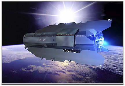 The ESA stated, "It is often assumed that gravity exerts an equal force everywhere on Earth. However, owing to factors such as the rotation of the planet, the effects of mountains and ocean trenches, and density variations in Earth's interior, this fundamental force is not quite the same all over." During two six-month uninterrupted periods, the satellite will map the subtle variations with extreme detail and accuracy, producing a unique model of the "geoid" — the surface of an ideal global ocean at rest, the space agency said.
Following initial testing, the satellite was brought to an altitude of around 158 miles, which is extremely low for an Earth observation satellite, the ESA said. As gravity is stronger closer to Earth, the satellite will orbit as low as possible while remaining stable as it flies through the fringes of Earth's atmosphere. "We are now entering science operations and are looking forward to receiving and processing excellent three-dimensional information on the structure of Earth's gravity field," said Rune Floberghagen, the satellite's ESA mission manager.
Following initial testing, the satellite was brought to an altitude of around 158 miles, which is extremely low for an Earth observation satellite, the ESA said. As gravity is stronger closer to Earth, the satellite will orbit as low as possible while remaining stable as it flies through the fringes of Earth's atmosphere. "We are now entering science operations and are looking forward to receiving and processing excellent three-dimensional information on the structure of Earth's gravity field," said Rune Floberghagen, the satellite's ESA mission manager.