
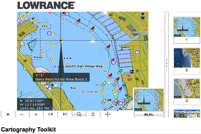
The new software tools and documentation allow experienced GIS engineers to convert content data into a format compatible with Navico’s extensive navigation range — including the Simrad NSE and NSO, Lowrance HDS and Endura product lines as well as the recently launched B&G Zeus multifunction display system. Offering an open and flexible platform for third-party mapping content providers, the toolkit gives partners the ability to produce and sell Navico-compatible cartography on securely encrypted SD and MicroSD cards. According to the announcement, the product incorporates all the tools required to build maps based on Navico’s Marine and Outdoor Database (NMOD) specifications, both raster and vector maps can be developed using the Cartography Toolkit. The kit consists of three tiers for different development needs. Each tier includes highly detailed documentation on the steps required to build a mapping solution, as well as sample projects for each type of map that can be created. Tier 1 provides tools to create inland marine vector maps in Navico’s proprietary AT5 and PSF formats. Tier 2 offers steps to build AT5 vector maps from S-57 formatted ENC data for marine products, and Tier 3 provides tools to create AT5 raster maps. The intelligent kit also provides a simple migration process that allows maps created in one tier to be ported to another tier without recreating data from scratch for each use. The Navico Cartography Toolkit is available for free to partners who have completed a Toolkit Licensing Agreement. Familiarity with GIS programs and basic GIS engineering skills are required for successful use of the toolkit.
Satnews Daily
January 17th, 2011
Navicon... Build-A-Map (GIS)
[SatNews] Navicon's Cartography Toolkit enables developers to create mapping content for the Company's marine and outdoor navigation products.
The new software tools and documentation allow experienced GIS engineers to convert content data into a format compatible with Navico’s extensive navigation range — including the Simrad NSE and NSO, Lowrance HDS and Endura product lines as well as the recently launched B&G Zeus multifunction display system. Offering an open and flexible platform for third-party mapping content providers, the toolkit gives partners the ability to produce and sell Navico-compatible cartography on securely encrypted SD and MicroSD cards. According to the announcement, the product incorporates all the tools required to build maps based on Navico’s Marine and Outdoor Database (NMOD) specifications, both raster and vector maps can be developed using the Cartography Toolkit. The kit consists of three tiers for different development needs. Each tier includes highly detailed documentation on the steps required to build a mapping solution, as well as sample projects for each type of map that can be created. Tier 1 provides tools to create inland marine vector maps in Navico’s proprietary AT5 and PSF formats. Tier 2 offers steps to build AT5 vector maps from S-57 formatted ENC data for marine products, and Tier 3 provides tools to create AT5 raster maps. The intelligent kit also provides a simple migration process that allows maps created in one tier to be ported to another tier without recreating data from scratch for each use. The Navico Cartography Toolkit is available for free to partners who have completed a Toolkit Licensing Agreement. Familiarity with GIS programs and basic GIS engineering skills are required for successful use of the toolkit.
The new software tools and documentation allow experienced GIS engineers to convert content data into a format compatible with Navico’s extensive navigation range — including the Simrad NSE and NSO, Lowrance HDS and Endura product lines as well as the recently launched B&G Zeus multifunction display system. Offering an open and flexible platform for third-party mapping content providers, the toolkit gives partners the ability to produce and sell Navico-compatible cartography on securely encrypted SD and MicroSD cards. According to the announcement, the product incorporates all the tools required to build maps based on Navico’s Marine and Outdoor Database (NMOD) specifications, both raster and vector maps can be developed using the Cartography Toolkit. The kit consists of three tiers for different development needs. Each tier includes highly detailed documentation on the steps required to build a mapping solution, as well as sample projects for each type of map that can be created. Tier 1 provides tools to create inland marine vector maps in Navico’s proprietary AT5 and PSF formats. Tier 2 offers steps to build AT5 vector maps from S-57 formatted ENC data for marine products, and Tier 3 provides tools to create AT5 raster maps. The intelligent kit also provides a simple migration process that allows maps created in one tier to be ported to another tier without recreating data from scratch for each use. The Navico Cartography Toolkit is available for free to partners who have completed a Toolkit Licensing Agreement. Familiarity with GIS programs and basic GIS engineering skills are required for successful use of the toolkit.