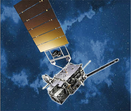
Artist's rendition of the GOES-R spacecraft in orbit, image courtesy of Lockheed Martin.
...optical-electronic lightning sensitivity testing in January at the Lockheed Martin Advanced Technology Center in Palo Alto and showed excellent performance. System gain, linearity, and dynamic range all exceeded specifications. Within the next few months, the GLM Engineering Development Unit will complete thermal and thermal-vacuum testing.
The heart of the GLM instrument is a high speed (500 frames per second), 1.8 gigapixel focal plane, integrated with low-noise electronics and specialized optics to detect weak lightning signals even against bright, sunlit cloud backgrounds. GLM is a new GOES capability. It is a near-infrared instrument that maps total lightning (cloud-to-cloud and cloud-to-ground) over the Americas and adjacent oceans to provide improved tornado warning lead time and early indication of storm intensification and severe weather. Changes in cloud-to-cloud lightning are related to the updraft strength in a thunderstorm. A rapid increase of the in-cloud lightning activity, called a storm's "jump signature," has been shown to precede severe weather at the ground by as much as 30 minutes. GLM's "total lightning" observations of thunderstorms across the entire country will provide the National Weather Service with advanced severe weather prediction capabilities to increase tornado warning lead-times, as well as decrease false alarms, which will save lives in storm-threatened areas.
The GOES mission is a critical element of the U.S. satellite constellation for environmental observations, along with the Polar Operational Environmental Satellite (POES) and Defense Meteorological Satellite Program (DMSP) polar orbiting satellites - both also built by Lockheed Martin. GOES is the environmental satellite most familiar to the American public, as its images and time-lapse sequences are the primary visual material of television weather forecasts.
The GOES system—operational since 1975—plays a vital role in weather and environmental forecasting. In orbit high above the equator, GOES satellites are uniquely positioned to monitor the development of hazardous weather, such as hurricanes and severe thunderstorms, and to track their intensity and movement so that loss of life and property can be reduced or avoided. The GOES Program is managed by the National Oceanic and Atmospheric Administration (NOAA), which establishes requirements, provides funding and distributes environmental data for the United States. NASA's Goddard Space Flight Center, in Greenbelt, Maryland, manages the GLM instrument development as a part of its support to NOAA's development of the GOES-R series of satellites.
GLM is one of the scientific instruments managed by Lockheed Martin's Sensing & Exploration Systems line of business. The instrument is being designed and built at Lockheed Martin's Advanced Technology Center (ATC) in Palo Alto, California. The ATC is the research and development organization of Lockheed Martin Space Systems Company (LMSSC). LMSSC, a major operating unit of Lockheed Martin Corporation, designs and develops, tests, manufactures and operates a full spectrum of advanced-technology systems for national security and military, civil government and commercial customers. Chief products include human space flight systems; a full range of remote sensing, navigation, meteorological and communications satellites and instruments; space observatories and interplanetary spacecraft; laser radar; ballistic missiles; missile defense systems; and nanotechnology research and development.

