
The ash cloud north of Scotland as observed by the MERIS instrument on ESA's Envisat satellite. Credits: ESA
Satellite data are showing that the eruption from Iceland's Grímsvötn volcano this week was unlikely to have posed a significant threat to airspace over central Europe. The Icelandic Met Office reports that eruption from Grímsvötn has subsided and that there is now virtually no ash being produced from the volcano. This major eruption began during the evening of May 21st and led to the disruption of around a thousand flights across Europe. Although this is minor compared to the chaos caused last year when Eyjafjallajoekull erupted, satellite data are showing that this week's eruption did not pose a serious threat to aircraft flying over central Europe. Satellite measurements offer an excellent means with which to follow the spread, extension, concentration and movement of volcanic plumes.
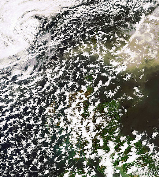
The MERIS optical instrument on ESA's Envisat satellite captured the position of the ash cloud close to Iceland and Scotland on May 24th. Atmospheric sensors such as Envisat's Sciamachy instrument have also provided information on aerosols, again consistent with the SEVIRI data. Ash dispersal prediction made on May 23rd Models that used satellite data to predict the path of the ash cloud earlier this week, such as that produced by the Norwegian Institute for Air Research (NILU), have shown to be in line with spaceborne observations over the last few days. This evidence indicates how satellite observations are of great value for services predicting ash cloud dispersal patterns.