

The Galileo Test and Development Environment (GATE) in Berchtesgaden amid the Bavarian Alps is a test range equipped with Galileo-like transmitters placed in high points for testing in advance of this European GNSS system becoming operational.
Credits: IFEN
...on how Europe’s two satellite navigation systems—EGNOS and Galileo—will work together in future. The helicopter flew a variety of manoeuvres, from fast loops to mid-air hovering, to see how satnav signals were received in practice. The promising results are now being analyzed. The airborne testing, which took place in Germany on September 24–26, was based around prototype signals of the next generation of the European Geostationary Navigation Overlay Service—EGNOS—combined with simulated Galileo signals. EGNOS, the first pan-European satellite navigation system, works by sharpening the accuracy of US GPS signals.
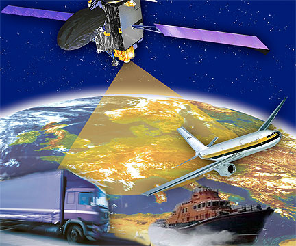
The US GPS global satellite navigation system is greatly sharpened to 1-2 m through the European Geostationary Navigation Overlay Service (EGNOS)
Credits: ESA
Kept busy by European industrial and research teams, GATE is owned by the DLR German Aerospace Center. ESA’s Global Navigation Satellite Systems for Europe (GNSS) Evolution program uses it to help prepare the design of next-generation systems. The helicopter testing relied on the SPEED platform—Support Platform for EGNOS Evolutions & Demonstrations—enabling a user to receive simultaneous real-time augmentation signals for both GPS and Galileo, in the same way that the intended next-generation EGNOS system will operate.
The ESA-designed EGNOS employs a trio of satellites, processing facilities and a network of ground stations to improve the accuracy of GPS satnav signals over European territory. The service is guaranteed to an extremely high level of reliability set by the International Civil Aviation Organisation: it is allowed just a one in 10 million chance of error. The satellite-based service provides horizontal and vertical guidance information for aircraft performing safety-critical landing approaches to airports in a similar way to existing Instrument Landing System devices—but with no local ground-based navigation infrastructure needed.
GNSS Evolution is also tasked with designing the next generation of more advanced Galileo satellites, proceeding on the basis that the first generation of satellites will need replacement in the course of the 2020s.

One of Eurocontrol's EGNOS pioneers, this Aurigny Airlines Trislander can perform EGNOS-guided approaches using runway procedures published for Southampton Airport in the UK and Alderney Airport in the Channel Islands. This activity took place through the partnership of the UK's National Air Traffic Services (NATS), Aurigny Airlines and Anglo Normandy Engineering, with the support of the UK Civil Aviation Authority and the States of Guernsey.
Credits: Eurocontrol