
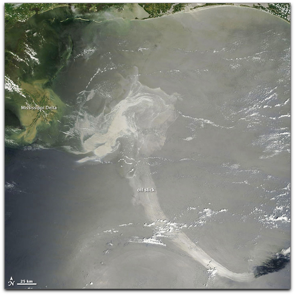
NASA image by Jeff Schmaltz, MODIS Rapid Response Team. Caption by Michon Scott.
The Moderate Resolution Imaging Spectroradiometer (MODIS) on NASA’s Terra satellite acquired this natural-color image. A substantial portion of the slick lingers near the Mississippi Delta. An long, relatively thin extension of the slick stretches toward the southeast. Sunglint — sunlight bouncing off the ocean surface and into the satellite sensor — helps illuminate the slick. A coating of oil smoothes the sea surface relative to the oil-free water, causing it to reflect light differently. In this image, the slick appears as an uneven shape of varying shades of gray-beige.