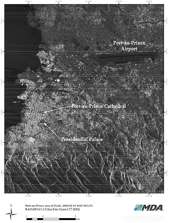
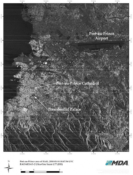
MacDonald, Dettwiler and Associates Ltd.'s (TSX: MDA) space-based imagery is being used to assess damage and direct relief efforts to the Haitian capital of Port-au-Prince from the January 12, 2010 earthquake. MDA has provided imagery acquired by the
RADARSAT-2 satellite over Haiti through the activation of the
Canadian Space Agency’s International Charter “Space and Major Disasters” in support of disaster recovery and reconstruction efforts.
Click To Enlarge
The first imagery covering the main stricken areas of Port-au-Prince was acquired on January 14, 2010, with more images to be acquired over the next coming days and posted on the MDA website for immediate download (
http://gs.mdacorporation.com/) Satellite imagery acquired immediately after the event provides updated views of how the landscape has changed and the extent of damage to critical infrastructure such as buildings, roads, and airports. These images can be compared with satellite imagery taken before the event to help identify areas that have been hit hardest by the disaster, determine passable routes for aid workers, as well as safe areas suitable for establishing aid camps to provide medical support and shelter.
Launched in 2007, RADARSAT-2 is the world’s most advanced commercial C-band
Synthetic Aperture Radar satellite. RADARSAT-2 offers new imaging capabilities and a faster turn-around schedule for data acquisition and product delivery. It provides enhanced information for applications such as environmental monitoring, ice mapping, resource mapping, disaster management, and marine surveillance. RADARSAT-2’s ability to collect imagery independent of darkness or inclement atmospheric conditions is a valuable support during times of emergency to supplement airborne and ground resources for local and regional damage assessment.
Topical Tags :
Regional Tags :