
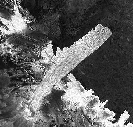
This Envisat Advanced Synthetic Aperture Radar (ASAR) image, acquired on 20 April 2011 in Wide Swath Mode, covers an area about 415 by 345 km over Victoria Land, Antarctica, (Latitude: 75S, 165E) and shows some ice tongues. The Drygalski Ice Tongue is the largest, extending about 100 km into the frozen Ross Sea.
ESA has now added nearly 13,000 radar images to the service, bringing the number of viewing possibilities to about 58 000. The MIRAVI service tracks ESA’s Envisat satellite around the globe, generates images from the raw data collected by its instruments, and provides them online — free of charge — within two hours. "We have been very pleased with the number of people using MIRAVI to explore our planet. This enthusiasm inspired us to offer new images that provide different types of information," said ESA’s Director of Earth Observation Programs Volker Liebig.
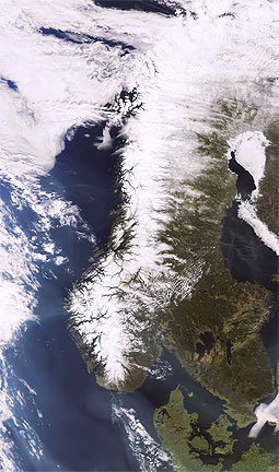
This Envisat Medium Resolution Imaging Spectrometer (MERIS) image, acquired on 23 April 2011 in Full Resolution Mode, shows a sunny Scandinavia in spring, with some snow still present in the elevated areas as well as some sea ice in the Gulf of Botnia.
To enjoy the service, simply visit the MIRAVI website — http://www.esa.int/miravi — and either browse the very latest images by clicking on the snapshots to the left, or view a specific location by selecting an area on the world map or entering its geographic coordinates. Users are able to search for optical or radar (mostly black and white) images or both simultaneously. Since its launch in 2002, Envisat – the largest Earth observation satellite ever built – has been providing scientists with the most detailed picture yet of the state of the planet.
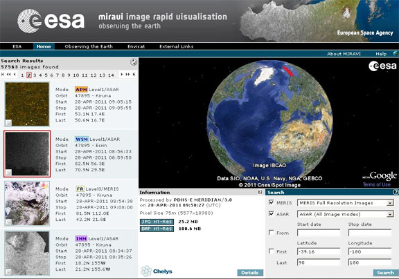
MIRAVI’s new interface allows users to search for Envisat optical and radar images. Either browse the very latest images by clicking on the snapshots to the left, or view a specific location by selecting an area on the world map or entering its geographic coordinates. Credits: ESA, Chelys