China... Made To Make Maps + An AIS Add (Launch)
 [SatNews] China has launched a new high-resolution remote sensing satellite....
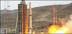
....on Monday at 03:17 UTC using the Long March 4B (Chang Zheng-4B -Y26) launch vehicle from the Taiyuan Satellite Launch Center. According to the official Xinhua News Agency, the ZiYuan-3 is the country's first high-resolution geological mapping satellite, to be used for civil purposes. The ZiYuan-3 (ZY-3) is the first of a new series of high-resolution civilian remote sensing satellites, grown from a project that was initiated in March 2008. The new satellite carries three high-resolution panchromatic cameras and an infrared multispectral scanner (IRMSS). The cameras are positioned at the front-facing, ground-facing and rear-facing positions. Two cameras (front-facing and rear-facing) have a spectral resolution of 3.5m and 52.3km ground swath while the ground-facing camera has a spectral resolution of 2.1m and 51.1km ground swath. The IRMSS has a spectral resolution of 6.0m and 51.0km ground swath.
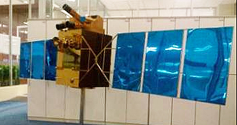 The ZiYuan-3 satellite.
At launch, the satellite had a mass of 2,630 kg. The satellite is equipped with two 3 meters solar arrays for power generation and will orbit a 505.984 km sun-synchronous solar orbit with 97.421 degree inclination. This orbit will have a re-visit cycle of 5 days. Operational period will be four years with a possible life extension to five years. The new satellite will conduct surveys on land resources, help with natural disaster-reduction and prevention and lend assistance to farming, water conservation, urban planning and other sectors, surveying the area between 84 degrees north and 84 degrees south latitude.
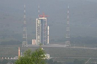 The Taiyuan Satellite Launch Center.
The satellites are operated jointly by the
Center for Earth Operation and Digital Earth (
CEODE) and the
Brazilian INPE (
Instituto Nacional de Pesquisas Espaciais - National Institute of Space Research). The
ZiYuan-2 program is probably used for aerial surveillance being operated by the
People’s Liberation Army (
PLA), while the new
ZiYuan-3 series will be used for stereo mapping (like the TH-1 TianHui-1 mapping satellite that is operated by the PLA). ZiYuan-3 will be operated by the
State Bureau of Surveying and Mapping.
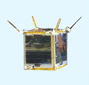 ORBCOMM's VesselSat-2 microsatellite.
Together with ZY-3, China also launched the
VesselSat-2 microsatellite built by
LuxSpace Sarl, an affiliate of
OHB AG. Vesselsat-2 weighs 28 kg and will be integrated into
ORBCOMM’s Next Generation (OG2) constellation of 18 AIS-enabled satellites after an in-orbit test and checkout phase. The specific orbit of the VesselSat satellites will allow ship monitoring and surveillance in the equatorial regions with a much higher revisit frequency than platforms in polar orbit. The exclusive rights to use the data of the
Automatic Identification System (
AIS) payload belong to ORBCOMM Inc., a global supplier of satellite-based communication and data services. (Source: NASA,
Rui C. Barbosa. — Images courtesy of ChinaNews.com and Xinhua).
Topical Tags :
Regional Tags :
