
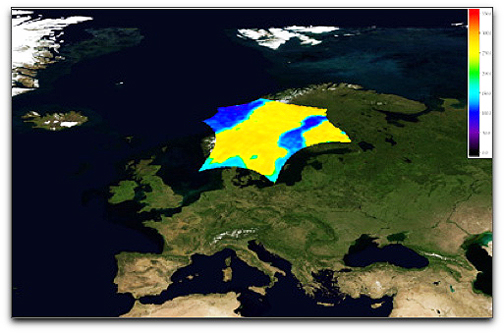
Image of brightness temperature over Scandinavia captured by SMOS. Credits: ESA
SMOS captures images of 'brightness temperature', which then require substantial processing to realise information on soil moisture and ocean salinity. Brightness temperature is a measure of the radiation emitted from Earth’s surface. During the commissioning phase, considerable effort is put into improving the quality of these images of brightness temperature before using them as input for the soil moisture and ocean salinity data products. ESA is now in a position to show the first results, which are very encouraging. Since it was launched, engineers and scientists from various institutes in Europe have been busy commissioning the SMOS satellite and instrument. This commissioning phase, which will continue until the end of April, initially involved testing the Proteus platform — a generic 'satellite bus' developed by the French space agency CNES and Thales Alenia Space — and the all-important MIRAS instrument developed by EADS-CASA in Spain under contract to ESA. Both platform and instrument have shown excellent performance during their first four months in orbit.