
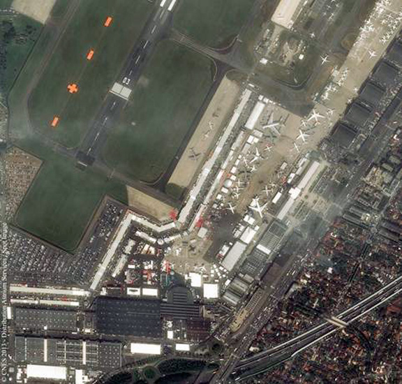
Pléides satellite image capture of the Paris Air Show, courtesy of Astrium.
Pléiades 1A and 1B are Europe’s first very-high-resolution Earth-observation satellites, and are positioned 180 degrees apart in the same quasi-polar heliosynchronous orbit, at an altitude of 695km. They offer exceptional performance in the civil market: 50cm products over a 20 km footprint and excellent flexibility (rapid pointing) allowing multiple acquisition modes (stereo, mosaic, corridor, target). Thanks to their unparalleled ability to acquire 900 images a day, they also offer major operational advantages to users.
The SPOT 6 and SPOT 7 constellation will operate in conjunction with Pléiades and will offer 1.5m resolution data over larger imaging swaths (60km) for mapping very large areas. The Pléiades (1A and 1B) and SPOT 6 and 7 constellations will be stationed at equidistant points in the same orbit around the Earth, making Astrium Services the first operator in the world able to offer a complete range of Earth-observation data at different resolutions (from medium to very high resolution). What this means is that every point of the globe will now be visible in high and very-high resolution on a daily basis.
It is this daily revisit capability that makes geo-information services a reliable part of the strategic and economic decision-making process, offering Astrium Services’ customers a number of advantages. These are as follows: Speedier access to images (war and crisis zones and natural disaster areas are visible in a matter of hours, anywhere in the world); the provision of images on a regular basis, enabling, for example, daily monitoring of activity at a specific location (rate of progress of civil engineering projects, surveillance of a military, industrial or mining sites, etc.); and twice the number of images (images are acquired twice as fast and with twice the chance of a cloud-free image being captured, making it the ideal configuration for mapping large areas).