
NASA image courtesy Jeff Schmaltz, MODIS Rapid Response Team at NASA GSFC using data courtesy of the University of South Florida. Caption by Michon Scott.
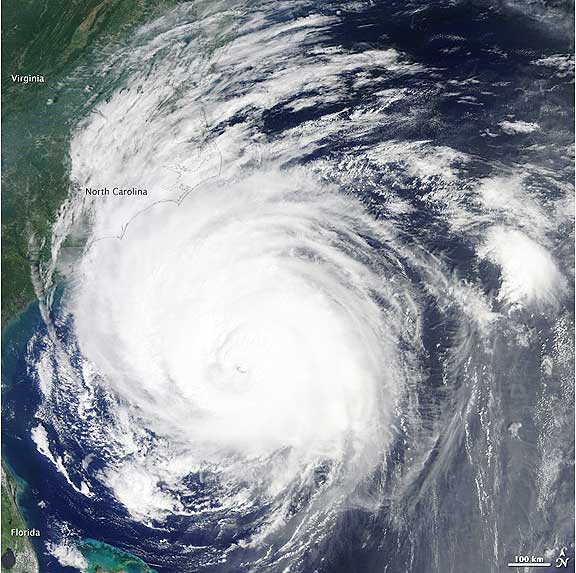
The NHC issued multiple hurricane watches and warnings, including a hurricane warning from Bogue Inlet, North Carolina, northeastward to the Virginia border; and from Westport, Massachusetts, around Cape Cod to Hull. The NHC also warned that a powerful storm surge could raise water levels by 3 to 5 feet (1 to 1.5 meters) in some places. The NHC forecast that Earl would turn toward the north-northeast and pick up speed on September 3. Even though the storm had begun to weaken, it was expected to remain a powerful hurricane as it passed the Outer Banks. Researchers participating in the Genesis and Rapid Intensification Processes (GRIP) mission flew NASA’s DC-8 and WB-57 planes and the robotic Global Hawk aircraft through and over Hurricane Earl on September 2 as the storm approached the Carolina coast. During flights earlier in the week, researchers noticed that dry air surrounded Earl. Hurricanes usually derive energy from moist air, and dry air can weaken or even stop a storm.