
 Under this agreement, Lockheed Martin and e-GEOS will provide the NGA with images acquired from the Italian COSMO-SkyMed satellites, which will be used to develop a wide range of US government applications. For e-GEOS, which is jointly owned by Telespazio (80 percent) and the Italian Space Agency (20 percent), the contract with the National Geospatial-Intelligence Agency represents a key commercial and strategic success in the highly competitive US defence market.
This achievement was made possible, thanks to the unique and innovative features of the COSMO-SkyMed satellite system. This is a dual-use system intended for both civil and military applications funded by the Italian Space Agency (ASI) and the Italian Ministry of Defence. The system is designed to operate using four satellites with synthetic aperture radar sensors (the first three satellite are already in orbit, while the fourth will be launched during 2010). These satellites are capable of operating day and night in all atmospheric conditions, and with frequent revisit times (every six hours at mid-latitudes with four operational satellites). The COSMO-SkyMed constellation can provide images with a resolution as high as 1 metre and has the capacity to record up to 2,400,000 square kilometres per day to be used for security applications, ground surveillance, environmental monitoring and natural resource management by public sector bodies and industry.
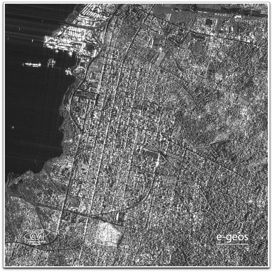
COSMO-SkyMed capture of Port-au-Prince on January 14th, 2010
COSMO-SkyMed, the Italian radar satellite constellation, acquired a high-resolution Spot image on January 14th, 2010, of Haiti’s capital, Port-au-Prince. Further acquisitions to obtain elements that will help assess the effects of the earthquake on the affected area have already been planned.
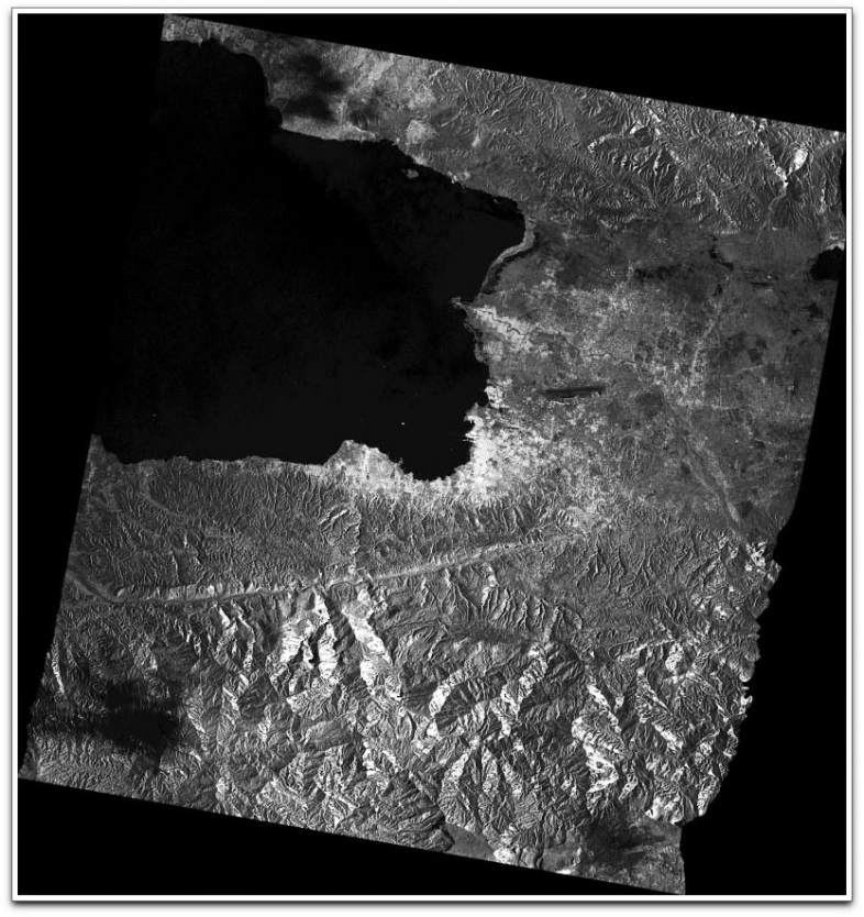
COSMO-SkyMed capture of Port-au-Prince, Haiti, on April 26th, 2009.
COSMO-SkyMed Stripmap archive image from April 26, 2009, of the area of of the Haitian capital Port-au-Prince. Another COSMO-SkyMed acquisition with the same geometry is planned, which will allow interferometric techniques to be applied to the pair of images, giving information on the deformation of the terrain caused by the earthquake.
Telespazio, a Finmeccanica/Thales company, was responsible for building the civil and military ground segments of the system, and now controls the constellation’s in-orbit operations from the Fucino Space Centre. e-GEOS, a joint venture between Telespazio and ASI, manages the acquisition and processing of the satellite data, and sells the data on the international market. (COSMO-SkyMed © ASI \ Italian MoD distributed by e-GEOS)