

A successful launch once again on June 23 by Indian Space Research Organisation (ISRO) of a large number of nanosats, 30 to be exact. ISRO is currently updating the status of each of the smallsats is listed here.
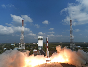
India's Polar Satellite Launch Vehicle, known as a workhorse, in its 40th flight (PSLV-C38), launched the 712 kg Cartosat-2 series satellite for Earth observation and 30 co-passenger satellites together weighing about 243 kg at lift-off into a 505 km polar Sun Synchronous Orbit (SSO). PSLV-C38 was launched from the First Launch Pad (FLP) of Satish Dhawan Space Centre (SDSC) SHAR, Sriharikota. This is the seventeenth flight of PSLV in 'XL' configuration (with the use of solid strap-on motors).
The co-passenger satellites comprise 29 Nano satellites from 14 countries namely, Austria, Belgium, Chile, Czech Republic, Finland, France, Germany, Italy, Japan, Latvia, Lithuania, Slovakia, United Kingdom and United States of America as well as one Nano satellite from India. The total weight of all these satellites carried on-board PSLV-C38 is about 955 kg.
The 29 International customer Nano satellites were launched as part of the commercial arrangements between Antrix Corporation Limited (Antrix), a Government of India company under Department of Space (DOS) and the commercial arm of ISRO and the International customers.
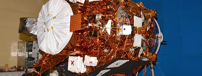
Cartosat 2 Series Earth observation satellite.
Cartosat-2 Series Satellite is the primary satellite carried by PSLV-C38. This remote sensing satellite is similar in configuration to earlier satellites in the series with the objective of providing high-resolution scene specific spot imagery. The imagery sent by satellite will be useful for cartographic applications, urban and rural applications, coastal land use and regulation, utility management like road network monitoring, water distribution, creation of land use maps, change detection to bring out geographical and manmade features and various other Land Information System (LIS) as well as Geographical Information System (GIS) applications.