

NASA’s Voyager 1 resumes sending engineering updates to Earth
NASA’s Voyager 1 spacecraft is depicted in this artist’s concept traveling through interstellar space, or the space between stars, which it entered in 2012.Credit: NASA/JPL-Caltech After some inventive sleuthing, the mission team can — for the first time in five ...
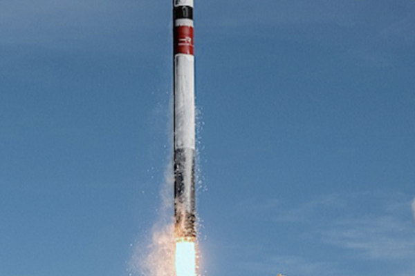
Rocket Lab’s New Zealand success deploys satellites to separate orbits 500km apart for KAIST and NASA
Following payload deployment to two separate orbits, Electron’s Kick Stage completed a final engine burn to lower its altitude and speed up its reentry to help reduce space junk. Rocket Lab USA, Inc. (Nasdaq: RKLB) , a global leader in ...

SpaceX’s double success a Starlink smallsats launch and the 300th Falcon booster landing
Photo by Satnews captured from SpaceX video stream. On Tuesday, April 23 at 6:17 p.m. ET, Falcon 9 launched 23 Starlink satellites packed inside the fairing atop the 230-foot rocket to low-Earth orbit from Space Launch Complex 40 (SLC-40) at ...
Today On Satnews
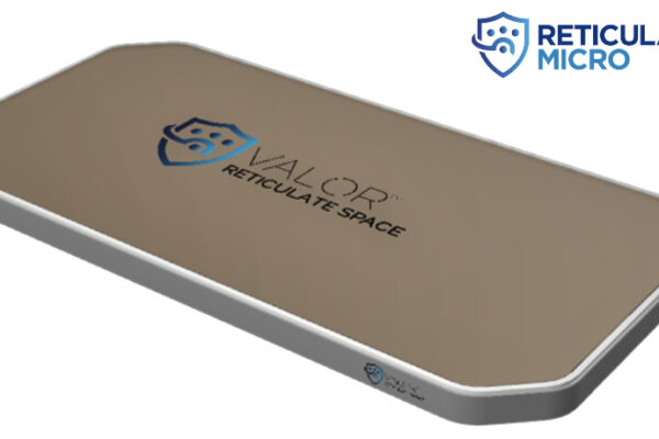
Reticulate Micro unveils VALOR™ ESA family of products
Reticulate Micro, Inc. has introduced their new, flat panel antenna product family. VALOR™, the second product debuting from Reticulate Space, is a flexible line of Electronically Steerable Antennas (ESAs) that feature standard core components purpose fit for users across land ...

Ariane 6 to fly the OOV-Cube
Europe’s newest rocket soon launches, taking with it many space missions each with a unique objective, destination and team at home, cheering them on. Whether launching new satellites to look back and study Earth, peer out to deep space or test important ...

Lynk receives a DISA Sat2Phone contract
Lynk Global, Inc. (Lynk) has signed a contract with the Defense Information Systems Agency (DISA) to provide commercial sat2phone services to the U.S. Department of Defense (DoD), the Department of Homeland Security (DHS), and other U.S. government agencies. This contract ...

Speedcast’s Singapore Teleport receives WTA Tier 4 certification
Speedcast’s Teleport in Singapore Joins WTA’s Growing List of Tier 4 Certified Teleports The World Teleport Association (WTA) today announced that Speedcast has achieved Tier 4 certification of its Singapore Teleport under WTA’s Teleport Certification Program. The Singapore certification marks ...

Satcom Global’s AuraNow VSAT coverage improves with Intelsat agreement
Satcom Global and Intelsat today announced a new global agreement, driving expansion and further enhancing the global Ku-band network behind the flexible and scalable AuraNow VSAT solution. Vessels with AuraNow on board will now benefit from the winning combination of ...

AeroVironment unveils AI + autonomy kit for UAS
AeroVironment (AV) has introduced its Autonomy Retrofit Kit (ARK) and AVACORE software demonstrating the company’s commitment to advancing autonomy and machine learning capabilities to increase effectiveness of autonomous systems and reduce operator burdens. AV’s Autonomy Retrofit Kit (ARK) and AVACORE ...

SES’s O3b mPOWER system begins high-performance connectivity services
SES announced today that O3b mPOWER, its second-generation software-enabled satellite system, is now operational and can provide high-performance connectivity services around the globe. With the first six O3b mPOWER satellites operating at medium Earth orbit (MEO) or 8,000km away from ...

Rocket Lab to receive $32 million from Space Systems Command for spacecraft for Tactically Responsive Space mission
Rocket Lab's Electron launch vehicle will be used to launch a Rocket Lab-built spacecraft for the Space Systems Command VICTUS HAZE mission. (Photo: Business Wire) Rocket Lab USA, Inc. (Nasdaq: RKLB) announced that it has been selected for a $32M ...

PLD Space has achieved 120 million euros in funding to date
PLD Space has reached 120 million euros in funding to date, thereby ensuring the company can meet upcoming technological and corporate milestones, all culminating in the launch of the MIURA 5 mission at the close of 2025. Since its foundation, ...
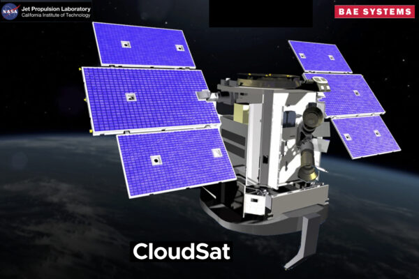
BAE Systems-built CloudSat satellite completes nearly two decades-long mission
The BAE Systems-built CloudSat satellite has officially ended operations after more than 17 years on orbit — CloudSat launched in April 2006 as part of a NASA-led mission to develop global cloud profiles to better understand how water and ice ...